
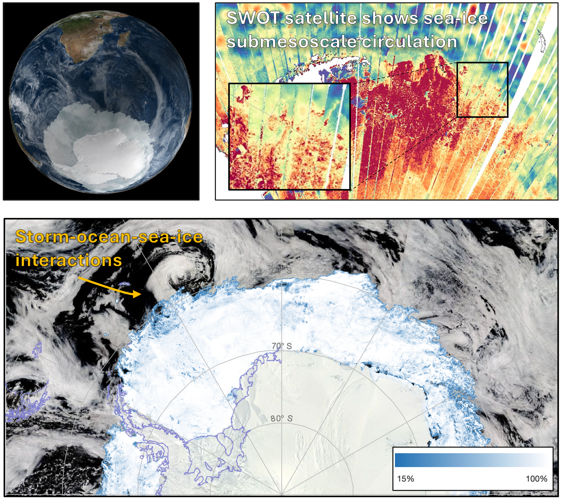
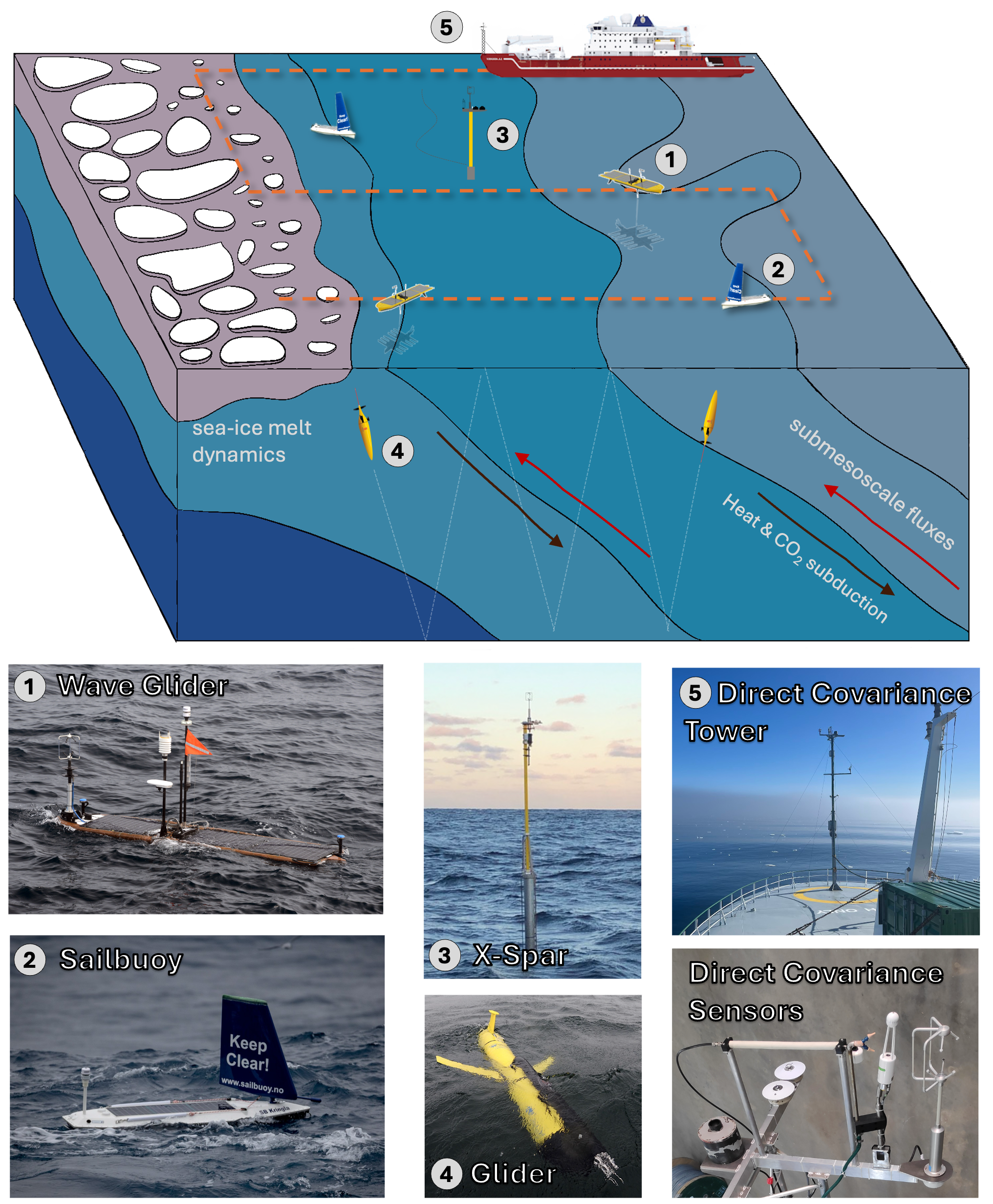
(Left figure) Southern Ocean Earth image from NASA satellite showing the vast expanse of sea ice across the Southern Ocean. SWOT satellite image showing intricate details of submesoscale imprint within sea ice structure. (Right figure) Project field plan and observational methods. Platforms are 1. Wave Glider, 2. Sailbuoy, 3. X-Spar, 4. Gliders, 5. Direct covariance tower.